07.03.2023
Using a data cube to monitor forest loss in the Amazon
Forests hold a vast amount of Earth’s terrestrial carbon and play an important role in offsetting anthropogenic emissions of fossil fuels. Since 2015, the world’s tropical forests can be observed regularly at an unprecedented 6 to 12 day interval thanks to the Copernicus Sentinel-1 mission.

Forest ecosystems are rapidly experiencing the impacts of climate change and timely forest monitoring is growing increasingly urgent.
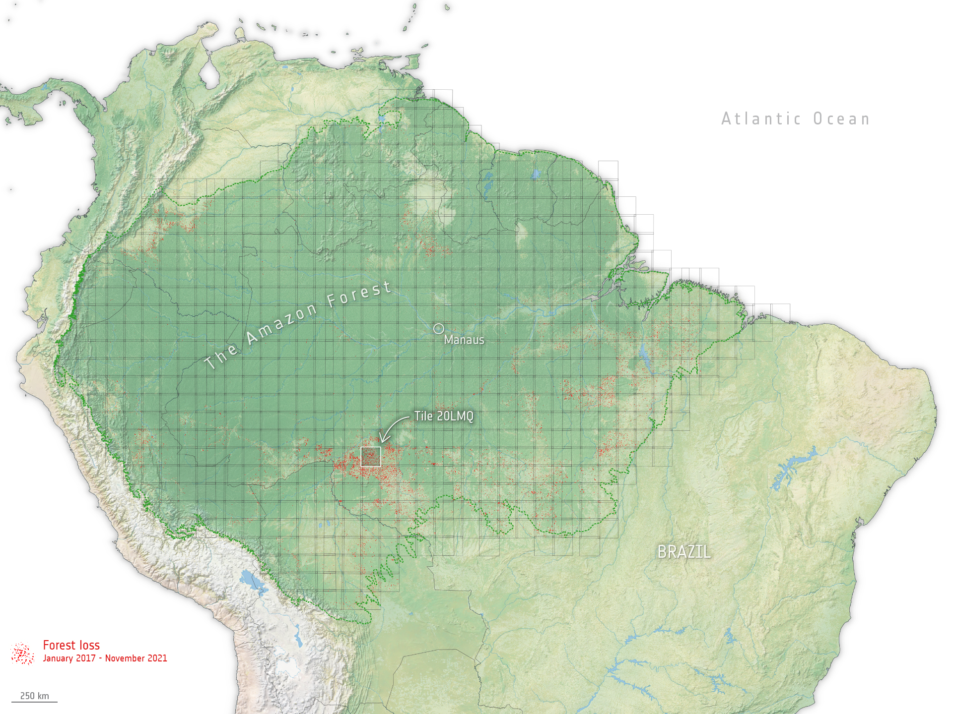
An ESA-led project, Sentinel-1 for Science: Amazonas, has processed billions of radar images over the entire Amazon basin and converted it into a data cube – helping detect forest loss.
A data cube is a simple a way of organising and viewing any sort of data with multiple dimensions, some of which are associated with space and time, that can help gain insights into patterns and trends that might not be immediately apparent otherwise.
From January 2017 to November 2021, the team detected forest loss of over 5.2 million hectares, which is roughly the size of Costa Rica.